Geospatial services for teams that act on their land
Geospatial services, engineered for decisions that matter.
From satellite imagery to interactive web maps — we turn geospatial complexity into clear, actionable strategy.
Working with teams building in
A geospatial technology company
We combine geographic information systems (GIS), satellite remote sensing, and spatial data engineering to help organizations better understand their environment. From environmental monitoring to market intelligence, we turn geospatial data into operational advantage.
Six disciplines, one geospatial partner.
Full capabilities from data collection to operational delivery
GIS Mapping
Site analysis, zoning studies, competitive mapping, and strategic spatial planning
Learn moreRemote Sensing
Satellite image analysis, change detection, land cover classification, and environmental monitoring
Learn moreWeb GIS
Interactive maps, geospatial dashboards, and real-time visualization platforms
Learn moreMarket Intelligence
Location analysis, demographic profiling, trade area analysis, and competitive mapping
Learn moreData Engineering
Geospatial pipelines, ETL automation, data quality control, and cloud infrastructure
Learn moreCustom Cartography
Thematic maps, custom cartographic products, atlases, and visual map design
Learn more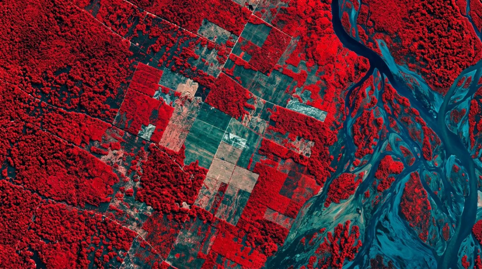
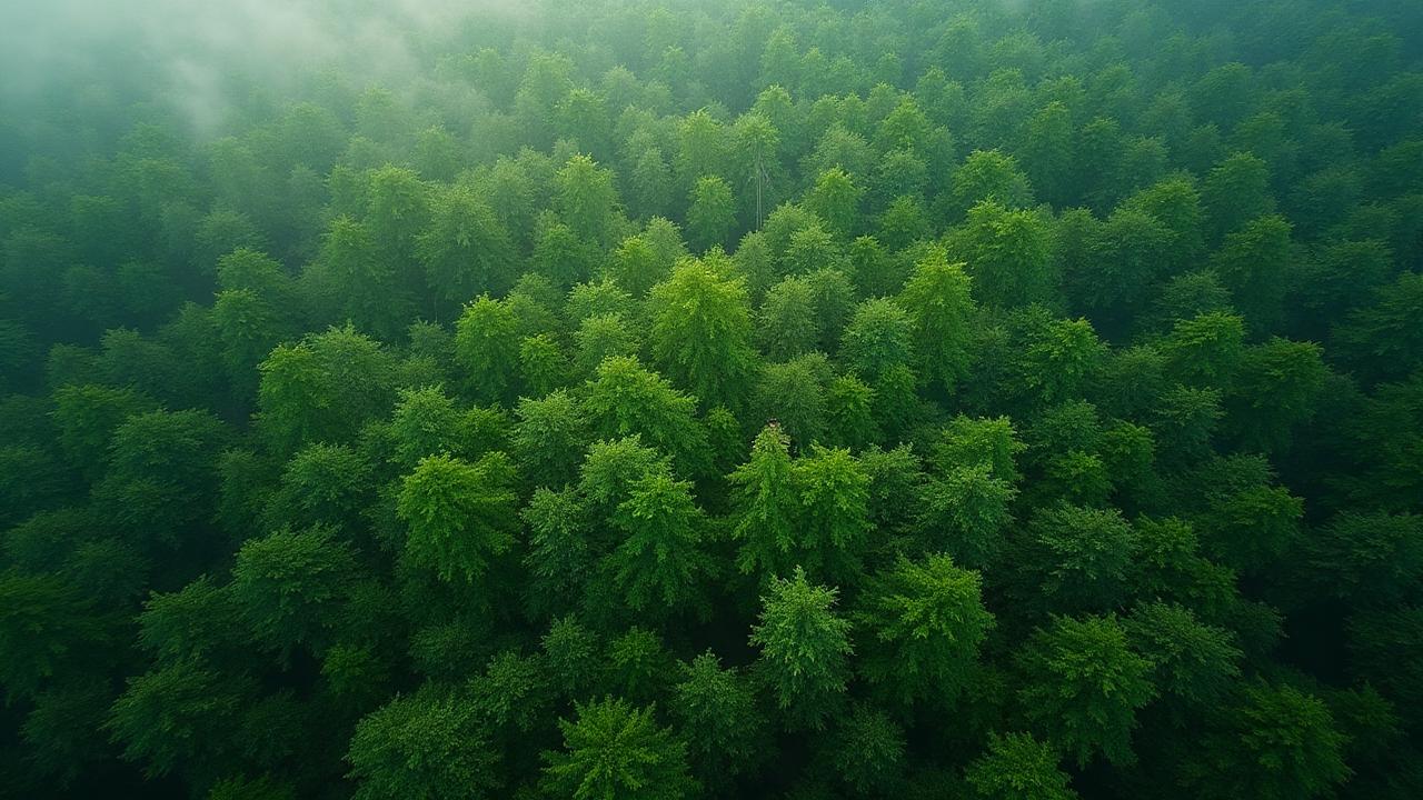
Satellite monitoring at global scale
We process multispectral satellite imagery to detect forest changes, build carbon baselines, and monitor crop health across hundreds of thousands of hectares
Our pipelines integrate data from multiple sources, apply radiometric corrections and cloud removal, delivering analysis-ready results
From data to decisions
A structured process from raw data to operational intelligence
Data Collection
Satellite imagery, GIS data, field data
We collect and aggregate spatial data from multiple sources — Sentinel, Landsat, Planet, and proprietary datasets — to build a solid analytical foundation
Processing & Analysis
AI models, spatial analysis, data enrichment
Advanced algorithms process data through classification, change detection, statistical modeling, and machine learning
Platform Integration
Dashboards, web maps, applications
Results are delivered through custom platforms — interactive maps, dashboards, and APIs tailored to client workflows
Decisions & Impact
Monitoring, reporting, insights
Continuous monitoring and automated reporting for data-driven decisions
Why companies choose us.
End-to-End Delivery
From raw satellite imagery to production-ready web maps — we handle the full pipeline. No handoffs between vendors, no gaps in the workflow. One team, one point of accountability, from data acquisition through platform deployment.
Advanced Geospatial Stack
We build on open-source foundations — PostGIS, GDAL, MapLibre, Cloud Optimized GeoTIFFs — combined with custom ML pipelines for classification, change detection, and predictive modeling. Enterprise-grade infrastructure without vendor lock-in.
Full Transparency, Always On
Every client works through our operational platform — live project status, tasks, time tracking, deliverables and contracts in one place. You always know exactly where your project stands, with no black boxes and no chasing for updates.
Our Own Web Visualization Platform
We run our own web-mapping platform for fast, interactive visualization of your geospatial data — upload datasets, style layers and share live maps straight in the browser, with no third-party GIS licences and no waiting on external tools.
Technical Partner for Geospatial & Environmental Projects
We support environmental, infrastructure, and climate projects with advanced GIS, remote sensing, and monitoring systems — from early-stage analysis to operational deployment.
Standards & Frameworks
- Verra VCS
- Gold Standard
- Plan Vivo
- ISO 14064 / 14067
- EU Taxonomy
- ESG Frameworks
Specialized Services
Remote Sensing & Analysis
Multi-temporal satellite analysis, change detection, monitoring
Land Use & Spatial Modeling
Land classification, suitability, scenario modeling
MRV & Monitoring Systems
Custom dashboards, reporting pipelines, data tracking
Compliance & Verification Support
Data packages aligned with international standards
Chaco Vivo REDD+ Project
One of the largest REDD+ conservation initiatives in the Gran Chaco region — over 186,000 hectares of forest under protection. We provide GIS and remote sensing expertise for baseline mapping, deforestation monitoring, and MRV system design.
IN PARTNERSHIP WITH
Select an industry
Discover how GIS and remote sensing solve industry-specific challenges
Environment & Climate
Carbon projects, forest monitoring, and sustainability mapping
Retail & Market Intelligence
Site selection, competitive analysis, and customer insights
Agriculture & Land Management
Precision agriculture, crop monitoring, and yield optimization
Real Estate & Development
Feasibility, market, and planning analysis
Infrastructure & Utilities
Network planning, asset management, and service optimization
Public Sector & Urban Planning
Urban planning, public services, and policies
Recent projects.
Clients across four continents.
Delivering geospatial solutions worldwide.
Ready to leverage geospatial data?
We turn your spatial data into a competitive advantage