

Before you build
Where should the pipeline, cable or road go?
The least-cost route modelled across terrain, land cover, protected areas and existing networks, with alternative corridors ranked.
Home/Industries/Infrastructure & Utilities
Networks, routes and assets for utilities and builders.
The types of analysis we run in this industry, each with its examples here.
All eleven typesThree moments when a network needs a map.
Before you build
The least-cost route modelled across terrain, land cover, protected areas and existing networks, with alternative corridors ranked.
Across a whole region
Assets found on aerial or satellite imagery with deep learning: propane tanks, reviewed in our map viewer, from a Texas pilot to the contiguous United States.
For the years it runs
Network data published in a geoportal the team can search, and CAD drawings converted into GIS layers.
The same work, in the form each person on your team needs.
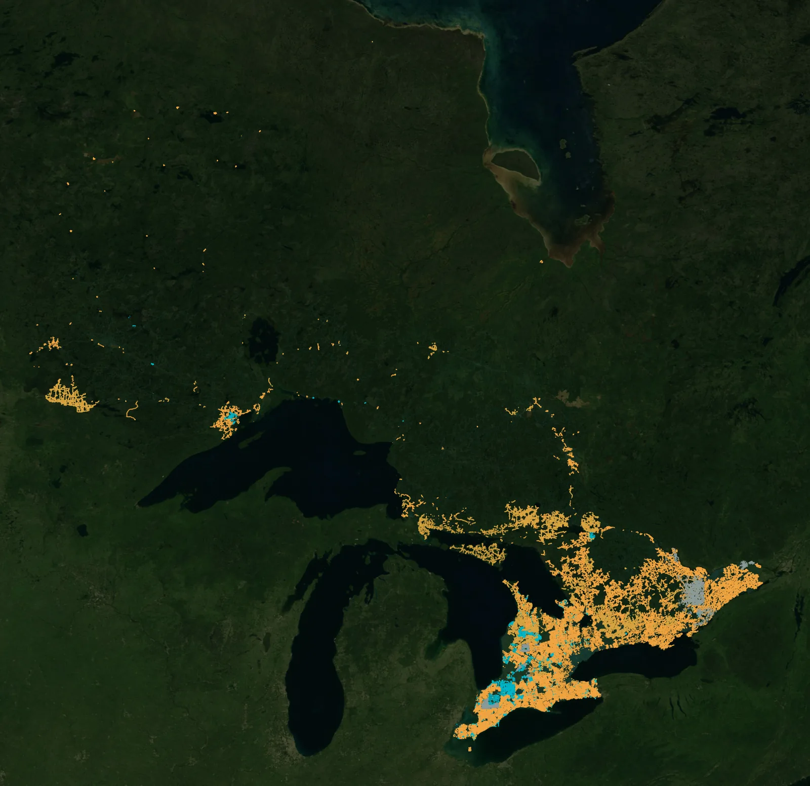
Ontario high-speed internet geoportal
A geoportal or web map to screen and monitor network projects, as we built for EXCap Advisors in Ontario.
See the projectOntario high-speed internet geoportal
A geoportal or web map to screen and monitor network projects, as we built for EXCap Advisors in Ontario.
See the projectThe projects we delivered in this industry: open one to see its page or its whole map.
All projectsYes. We model the least-cost route across terrain, land cover, protected areas and existing networks, and rank alternative corridors.
Yes, with deep learning. We detected propane tanks on aerial imagery, reviewed them in our map viewer, and scaled the work from a Texas pilot to the contiguous United States.
Yes. We processed data on Ontario's high-speed internet networks and network projects, and built a geoportal to screen and monitor the projects, for EXCap Advisors.
Yes. We convert and georeference CAD and legacy plans into GIS layers your team can query.
The same way of working, for other kinds of project.
 Carbon, Forests & EnvironmentCarbon projects, forest monitoring and MRV.
 Agriculture & Land ManagementCrop monitoring, field analytics and land-use change.
 EnergySite selection and land screening for renewable energy.
 Real Estate & DevelopmentParcel screening, zoning and flood constraints.
 Retail & Market IntelligenceBest locations, trade areas and competitors.
 Public Sector & Urban PlanningUrban planning, flood risk and public services.
Tell us the area, the decision and the deadline. We reply within 24 hours, from the person who will deliver the work.
Based in Bucharest, working with clients on five continents.
